Peel Gold Project
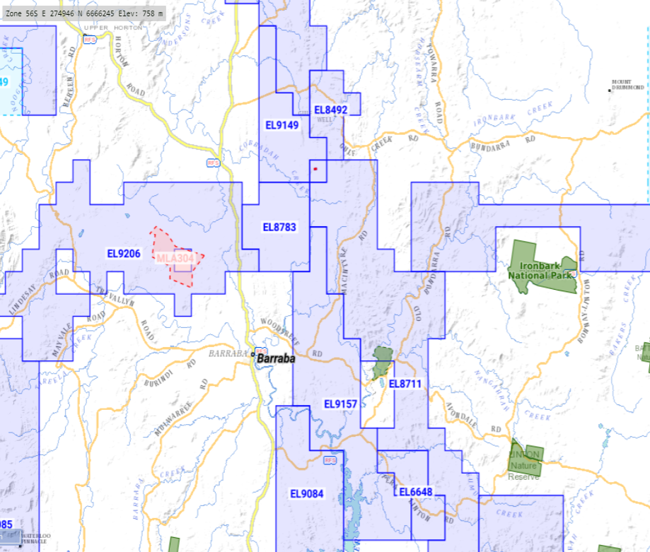
The package comprising the Peel Gold Project is two granted exploration licenses, EL9149 (15 units) and EL9157 (42 units). The licenses were granted over 15 units or 45 sq. kms or 4,500 ha for EL9149, and 42 units or 126 sq. kms or 12,600 ha for EL9157.
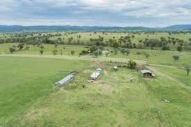
The southern boundary of EL9149 is located 15 kms northeast of the township of Barraba, and EL9157 is located approximately 2 kms east of Barraba. Barraba is located 476 kms northwest of Sydney and 90 kms northwest of Tamworth on the Fossickers Way, or the B95 highway.
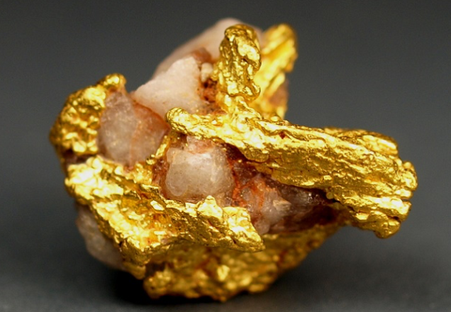
The licenses straddle and proximal to the Peel Fault System in the New England Fold Belt in New South Wales, Australia. The Peel Fault System has historically produced eleven tonnes of gold.
The licenses are 100% owned by wholly owned subsidiaries of Minerals City Pty Limited. Both are granted exploration licenses (ELs) with a term of three (3) years from 3 May 2021, both expiring 3 May 2024.
The Peel Fault System is an easterly dipping reverse fault that extends over a 270 kms in length from Warialda in the north to the south of Nundle. The system has been subject to prospecting and the production of gold since 1875, whereby offsets or jogs on geo-sutures within the Peel greenstone belts are a favoured focus for gold mineralisation in this area.
The conceptual justification for the exploration licenses is based on the existence of the regional Peel Fault System (within and proximal to the Project) which is a significant and deep geological structure that has acted as the fluid pathway for gold-bearing fluids from deeper crustal levels. Whilst a large proportion of the Peel Fault sits on the adjacent tenement to the east, a highly regarded and proven successful exploration methodology is to explore on 2nd and 3rd order structures to the main fault system for short-strike length, high-grade gold deposits that extend at depth combined with the package being significantly underexplored, makes the Project an excellent tenement package. It is also well positioned with respect to infrastructure.
In addition, the historic Kellys Reef Prospect that sits immediately to the east of the EL9157 boundary (within the Woodsreef MAA) has many veins that have been historically assayed up to 620 g/t Au, and the run of mine quartz in 1900 assayed 47 g/t Au. These results suggest a rich mineralized system exists with the potential to define it further with modern exploration techniques.
The Mother Lode system in central eastern California’s geological setting, the rock types, alteration and mineralisation products are very similar to the Peel Fault and Peel Gold Project geology. The Mother Lode system is located on the western margin of the Sierra Nevada. As a proxy, a long shear and structural system greater than 190 km in length and about 1.5 km in width displays gold mineralisation and quartz veins or shears within metasediments, volcanics and serpentinised ultramafic rocks. The Mother Lode, also known as the California Gold Belt, actually has several divisions as opposed to one giant section of gold-bearing veins. It carries the most productive and best-known mining districts in California's gold country. Although the entire foothill region of the Sierra Nevada is sometimes loosely termed the "Mother Lode Country," technically the Mother Lode is a 120-mile-long system of linked or en echelon gold-quartz veins and mineralized schist and greenstone.